Your turnkey 3D building survey
A 3D survey is a precise representation of reality in a digital format. It is obtained by using 3D capture techniques such as photogrammetry or lasergrammetry. It can be raw in the form of a point cloud or reprocessed as a technical study, architectural drawings or a 3D BIM model.
3D scan of building
We use the technology best suited to your requirements and budget, from capturing to producing your deliverables: dense point cloud, textured mesh, BIM or 3D model, 2D CAD documentation or technical studies.
1. Planning
3D laser scan, drone capture, BIM model, dwg plans… Let’s define your project.
2. 3D scan
We capture reality from all angles to create a quality 3D scan.
3. Processing
We assemble the data to produce an accurate and reliable point cloud.
4. Reprocessing
We reprocess the point cloud to create 2D plans and 3D models.
5. Delivery
We send you your 3D survey, downloadable via a simple link.
3D Survey and 3D Capture
We implement the appropriate technology to create a reliable and accurate point cloud
The basis of any 3D survey project is the creation of a reliable and accurate point cloud.
It is a representation of space in the form of thousands of colorized and referenced points forming a copy of reality.
There are several technologies to capture reality depending on the type of space, the expected accuracy and the purpose of the project. In particular, we use 3D laser scanner and aerial photogrammetry with georeferencing.

3D survey and BIM model
We reprocess the point clouds to create 3D models

Point clouds are unstructured files that need to be reprocessed in order to be easily used in architectural software.
We use them as layers to draw a 3D BIM model of the building as it is in reality.
We adapt the level of detail (LOD) of the representation to your needs.
It is manual work that requires a lot of rigor and for which we have a Revit certification.
3D survey and architectural plan
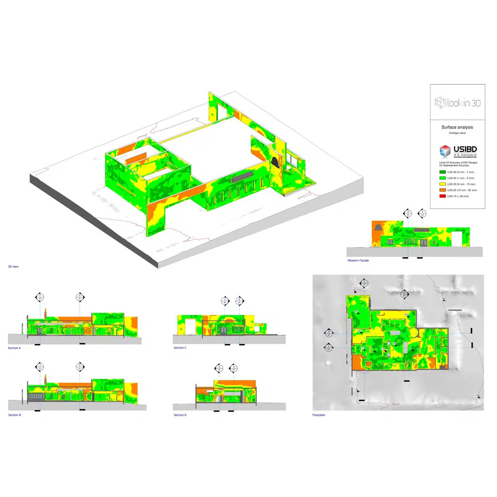
We remove the point clouds to create 2D architectural plans.
We use point clouds from 3D scans to create turnkey 2D documents.
Level plan, building section, facade survey, ground plan, etc. We provide dwg and pdf files that can be used directly by an architect, a design office or a project manager.

3D survey and technical studies

The clouds we produce during our 3D scans can also be used as support for technical studies such as :
- Strain studies
- Elevation studies
- Surface or cubature studies.
Your project available online
Each project is delivered with a 3D reader allowing you to access your 3D scan without software.
The main users of 3D scans are generally technicians using specific business software such as Revit or Autocad.
However, recordings are a powerful tool to communicate with your customers and providers without having to move.
This is why for each project we deliver a virtual tour accessible without software viaa simple browser, on any support (computer, tablet, smartphone).
Your 3D survey everywhere in France
Lookin3D is based between Paris and Annecy with a network of professionals in several regions of France. Do not hesitate to contact us!
Contact and quotes
Each project is unique To provide you with the best possible service, let’s take the time to discuss your requirements.


